Pix4D defines digital mapping and photogrammetry. Trusted by experts in fields ranging from surveying to agriculture to public safety, its unique software suite makes professional photogrammetry accessible to everyone.
All Pix4D software is designed with the help of industry experts for smoother workflows, repeatable results, and the outputs you need to take the next step. Industry partners and users help shape the future of its products, from the field to the cloud.
Pix4Dmapper has been the industry standard for almost a decade - but the company hasnt stopped working. Pix4Dmapper was joined by Pix4Dfields, the advanced agriculture mapping software as well as Pix4Dreact, where the fast-stitching technology has redefined emergency mapping for public safety professionals.
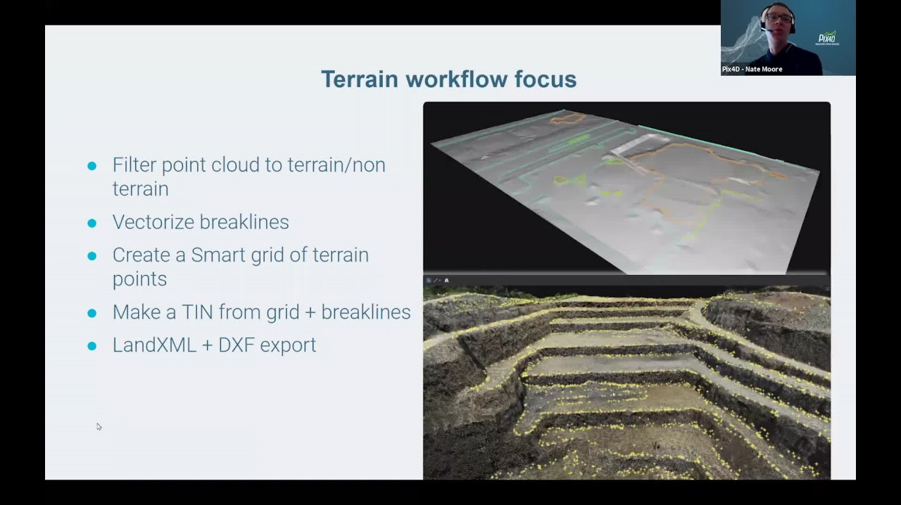
In 2020, Pix4D was proud to introduce more tools: Pix4Dcloud as the online photogrammetry platform, Pix4Dscan and Pix4Dinspect for aerial infrastructure inspection and asset management, Pix4Dmatic for large scale and corridor mapping, and Pix4Dsurvey for powerful vectorization and CAD-ready workflows. At the end of the year, Pix4D launched Pix4Dcatch, the mobile scanning app that turns handheld devices into 3D scanners.